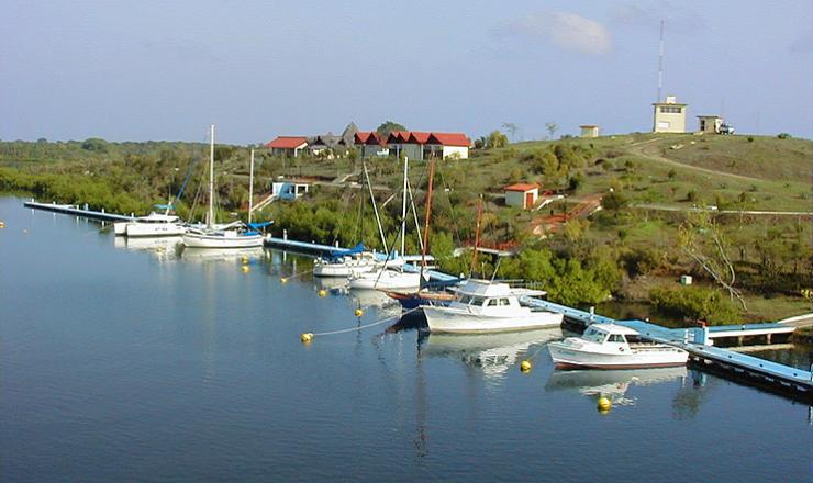
A Great Setting for Enjoying Water Sports 
One of the Caribbean’s most enchanting sailing areas, Cuba has it all—natural marvels, gorgeous weather and historical charm. The first known sailor to drop anchor off this green-and-blue isle was Christopher Columbus, who in 1492 declared it “the most beautiful land human eyes have seen”. Ernest Hemingway spent three decades tooting around the Cuban keys in his fishing boat, the Pilar, then immortalized them in his novels, The Old Man and the Sea and Islands in the Stream. And Fidel Castro sailed the Cuban seas in his cabin cruiser, the Granma.
 An archipelago in the Greater Antilles, Cuba lies at the mouth of the Gulf of Mexico, some 180 kilometres south of Florida, 140 kilometres west of the Bahamas, and 210 kilometres east of Cancun. While it is directly in the path of the Gulf Stream, the current is not strong—averaging less than half a knot, and sometimes reaching a maximum of three knots.
Cuba’s 5,746-kilometre coastline is marked by 200 sheltered bays, more than 4,000 keys and islets and 588  kilometres of beach. Most shores are covered with mangroves and cut by rivers, creeks, marshes and lagoons. Parts of the coast are rocky and steep. Both the Atlantic and Caribbean sides of the island are sheltered by coral reefs, one of which is part of the world’s second-largest reef originating in South America. Through-water visibility is 30 to 40 metres, and the surface water temperature averages between 24°C and 29°C.
On the north coast, the ENE winds prevail, while in the south ESE and SE winds predominate. Average wind speed varies between eight and 12 knots. Hurricane season is June to November, with September and October being the highest-risk months. While Cuba’s average air temperature is 25.5°C, the island has about 20 cold fronts a year. These last for two or three days and come with high swells and dramatic temperature drops. Nevertheless, Cuba averages 330 days of sunshine a year.
| Ports of entry: |

Cuba welcomes sailors from around the world. Some arrive on their own boats; some on chartered vessels; others on cruise ships. Cruise-ship facilities abound in Havana, Cienfuegos and Santiago de Cuba, although vessels also dock at the Isle of Youth, Nuevitas Bay and the northern coast of Holguín province.
Ports of entry provide customs clearing as well as dockage, electricity, provisions, water, fuel and minor repairs. Authorized ports of entry for non-Cuban vessels are:
Habana
Marina Hemingway
Varadero
Marina Puerto Sol Darsena de Varadero
Marina Gaviota Varadero
Ciego de Avila (the “Cuban keys”)
Marina Gaviota Varadero
Holguin
Base Nautica Gaviota de Naranjo
Base Nautica Marlin Boca de Sama
Santiago de Cuba
Marina Marlin Punta Gorda
Cienfuegos
Marina Puertosol Jagua
Los Canarreos
Marina Puertosol, Cayo Largo
Pinar del Rio
Maria La Gorda Centro Internacional de Buceo Puertosol
| Entry procedures: |
Be sure to contact port authorities before you reach jurisdictional waters (12 miles from the base line). Use these communication channels:
-HF (SSB) channel 2760 (national coastal network) and 2790 (tourism network); or
-VHF channel 68 (national coastal network) and 16 (tourism network).
Port authorities will ask you for the following information:
-name of yacht
- flag
-port of registry
-last port of call
-port of arrival
-estimated time of arrival (ETA)
-type of craft
-colour of craft
-number of persons on board
You must follow the instructions given by the port authorities and remain on board until all legal formalities are concluded. Each crew member must have a valid passport and tourist card.
Charts and details:
| Charts and details: |
Nautical charts and the official companion booklet, Yachtsman’s Guide, Cuba, can be ordered from
Cadena de Marinas Puertosol S.A.
Edificio Focsa, calle 17 esq. a M, Vedado
Ciudad de La Habana, Cuba
Tel: (537) 33 4705, Ext. 08
Fax: (537) 33 4703
Email: psolger@teleda.get.cma.net
 27.24°C


